

These instructions are for downloading data files to display on Google Earth, which is how Curvature was originally shared with the world. While most users will likely use the map that you can view in your web browser, these downloadable files may be of interest for Google Earth users, offline viewing, or other purposes.
The Curvature program generates zipped KML map files (with a .kmz file extension) that can be viewed in Google Earth. These map files are generated for all regions of the world and are refreshed every month or so to take into account updates to the underlying data sourced from the OpenStreetMap.
Step 1: Install Google Earth
To view Curvature KML files, you will first need to install Google Earth on your computer. Google Earth is a free program available for both desktop computers as well as mobile devices.
Step 2: Download a Curvature KML file
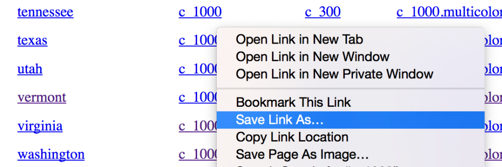
Head to https://kml.roadcurvature.com/ to download a compressed KML file for a region. The KML files are ordered by continent, country, and state/province. Curvature produces three levels of data files:
- c_1000: these files highlight the most twisty roads
- c_300: these files include less twisty roads in addition to the most twisty roads
- c_1000.curves: these files highlight individual road segments (as described on the Detected Curves KML Files page)
Most people will want to download the “c_1000” version of the files as these highlight only the most twisty roads — those with approximately 1km or more of curves.
Click on the “c_1000” link to download the file to your computer. Usually it will end up in a “Downloads” folder on your computer.
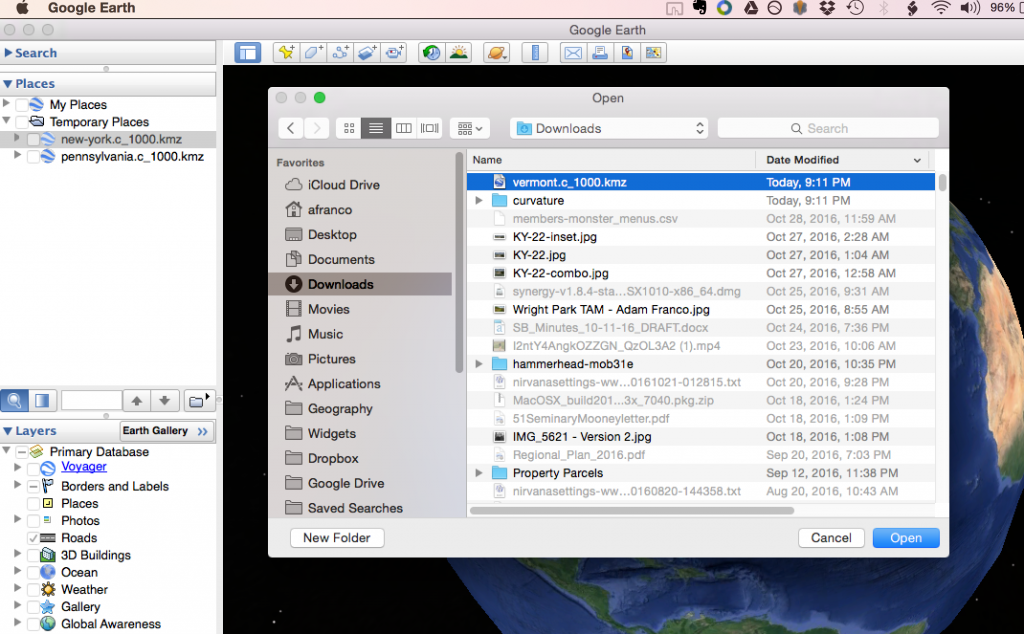
Step 3: Open the KML file in Google Earth
Find the KML file in your downloads folder. It will be named something like “vermont.c_1000.kmz”.
Double click on it to open it in Google Earth. If for some reason it doesn’t open, first open Google Earth and choose “File » Open…” and select the file.
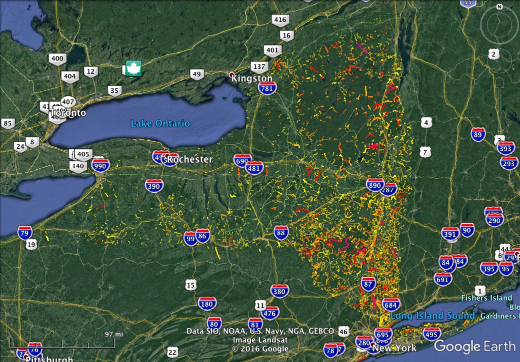
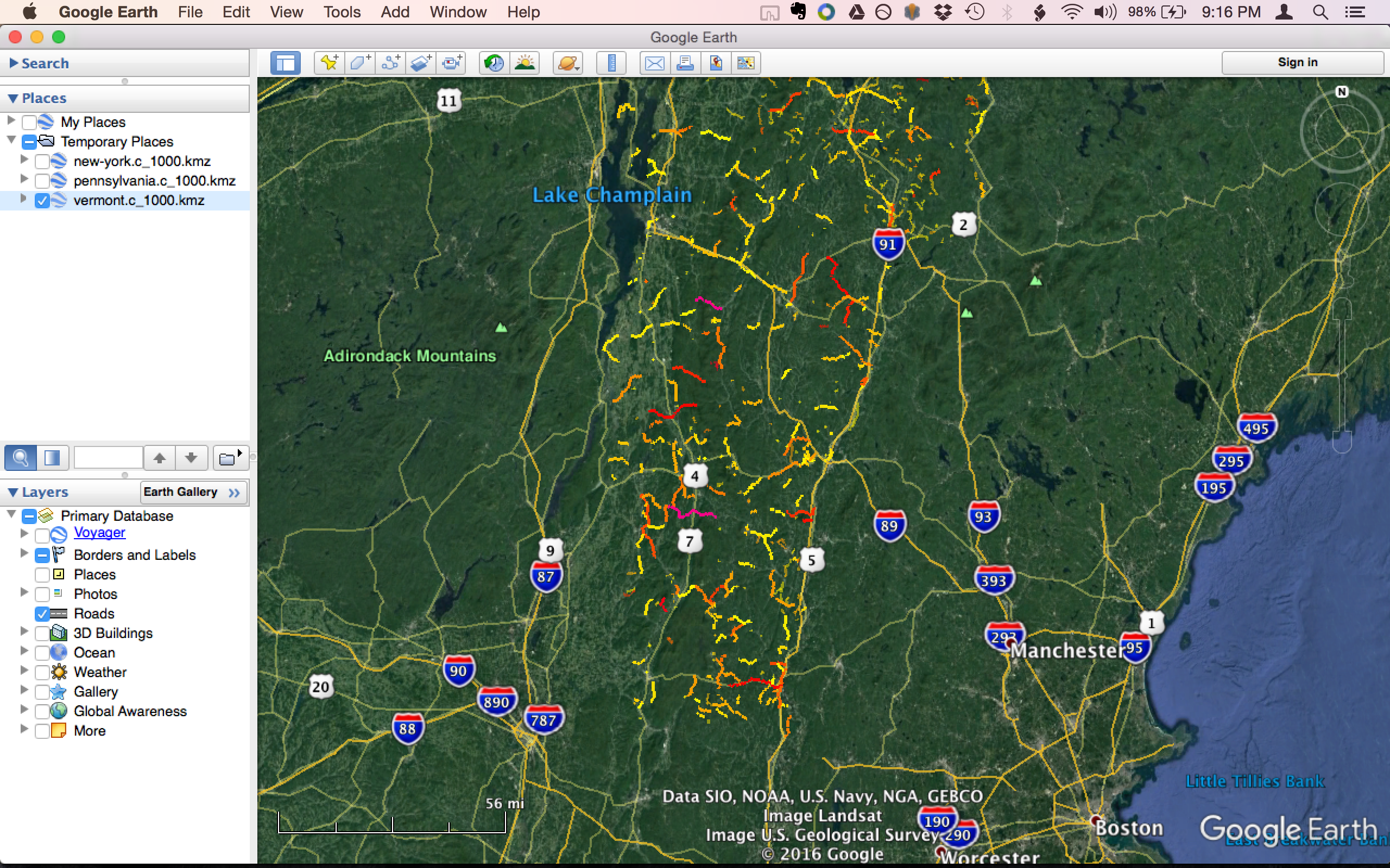
4. Look for curvy roads
After you’ve opened the file in Google Earth you can zoom around and identify curvy roads:
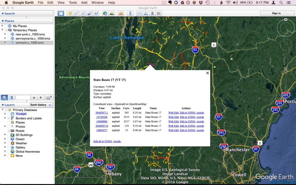
Clicking on a road will pop up details indicating any surface tags for each segment as well as length and curvature value:
Step 5: Plan your route
Google Earth doesn’t have great built-in route-planning tools, so it is usually easiest to simply identify the curvy roads via the Curvature files in Google Earth, then plan your route using other route-planning software such as Garmin Base Camp, Google Maps, or similar.