

I’m happy to announce the launch of a new in-browser Curvature map with worldwide coverage. Now you can browse the map without any need to download KML files and open them in GoogleEarth. Planning trips on twisty roads has never been easier.
Coverage
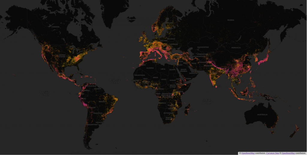
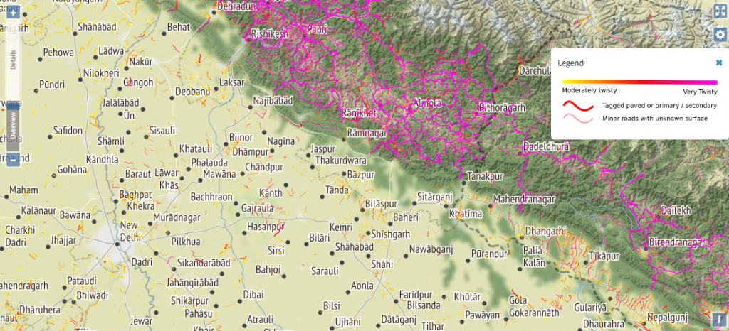
The new map is backed by a database of over 10 million road segments that have been analyzed by the Curvature algorithm and determined to be at least moderately curvy. By drawing from a single database, the new map spans regions seamlessly. Planning trips across country and state boundaries no longer requires loading additional data files for each region.
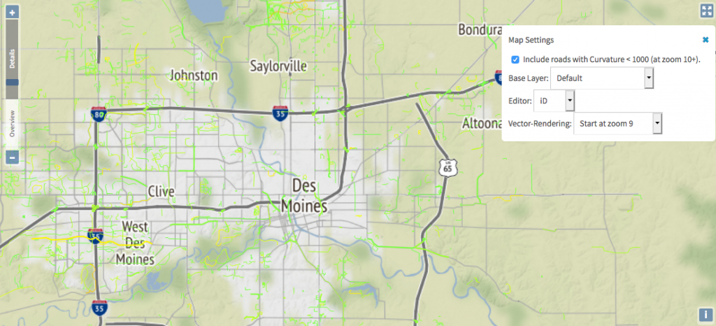
In addition to displaying the most twisty roads (with a curvature greater than 1000) across the whole world, the new map also allows users to view moderately twisty roads when zoomed in. This is particularly useful for those who live in flat areas where most roads are straight. This option for less-twisty roads is available in the settings panel.
More background layers
By default, the new map uses the CARTO Dark background when zoomed out to make the distribution of twisty roads easier to visualize on a global or continental scale.
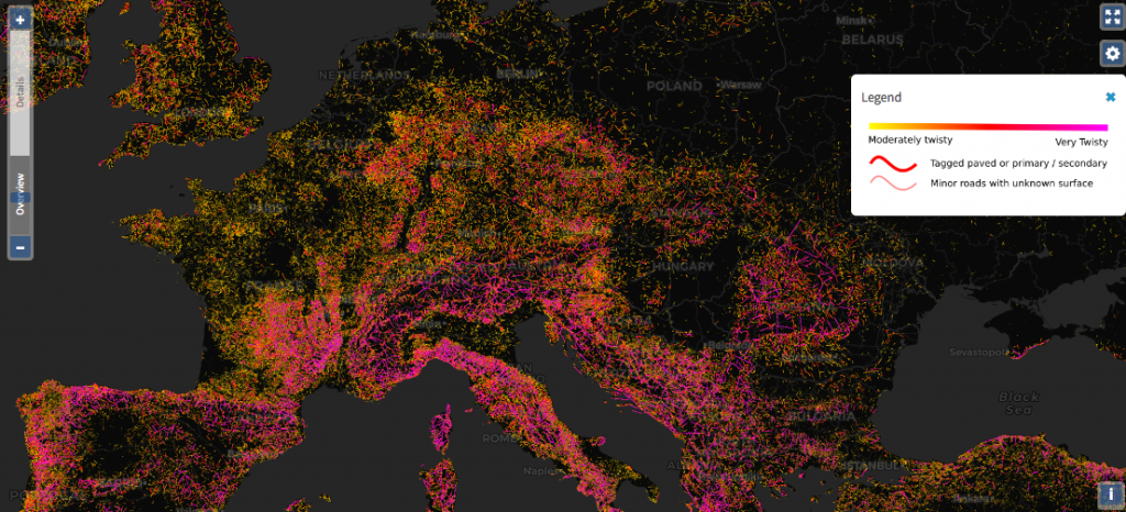
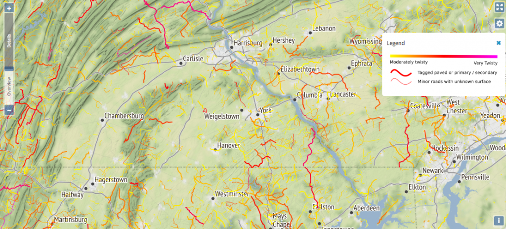
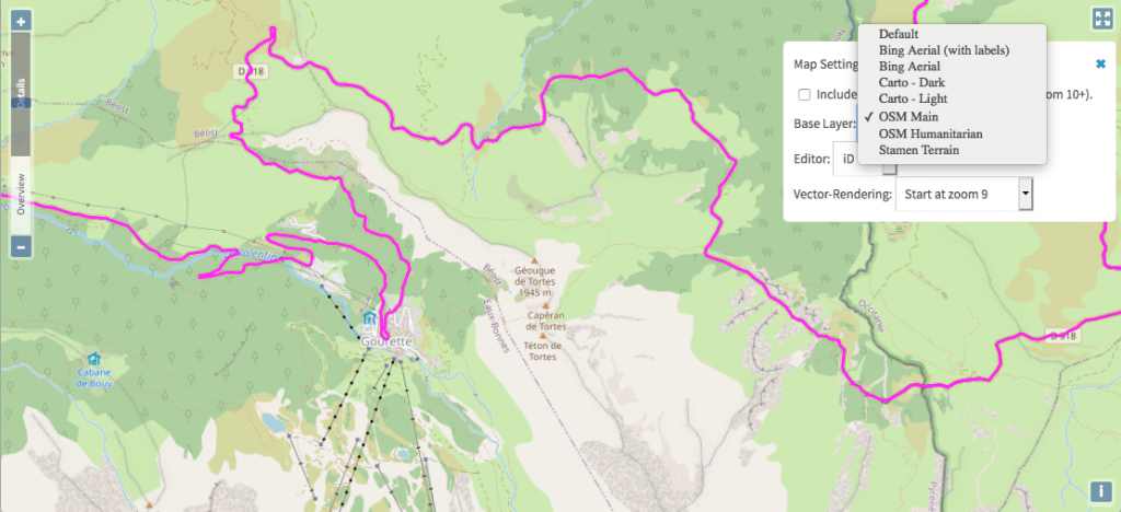
As you zoom in, the map switches to the Stamen Terrain background at medium zooms to provide more positional context of hills and mountains and rural versus urban areas while still being plain enough to easily see the highlighted roads.
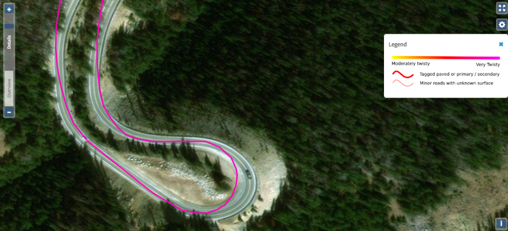
Finally, as you zoom in all the way, the background switches to Microsoft’s Bing Aerial satellite imagery to allow you to confirm road surface and see other details.
The default setting switches backgrounds to provide the most useful context at each zoom level, but you can set a particular background to be used at all zoom levels in the settings. In addition to the three backgrounds used in the default set, additional background maps are available. As an example, you may wish to switch to the main OpenStreetMap (OSM) rendering as a background to identify towns, shops, tourist attractions, or hiking trails when planning a trip. The density of information in this map makes it a less ideal background for searching for roads, but it is great for other purposes.
Mobile friendly
The new map is mobile friendly and works on all modern browsers on both desktop and mobile devices. Use the full-screen button in the top right to hide all menus and show just the map—especially useful on small screens.
Permalinks
The location, zoom, and background setting are included in all map URLs so that you can easily share your view of the map with travel partners or anyone else.
Road details and editing
As you browse through the map, notice the zoom slider on the left. When you zoom into the “Details” range, roads become clickable and the dialog that pops up will display the road name and/or route number, curvature value, length, classification, and surface information.
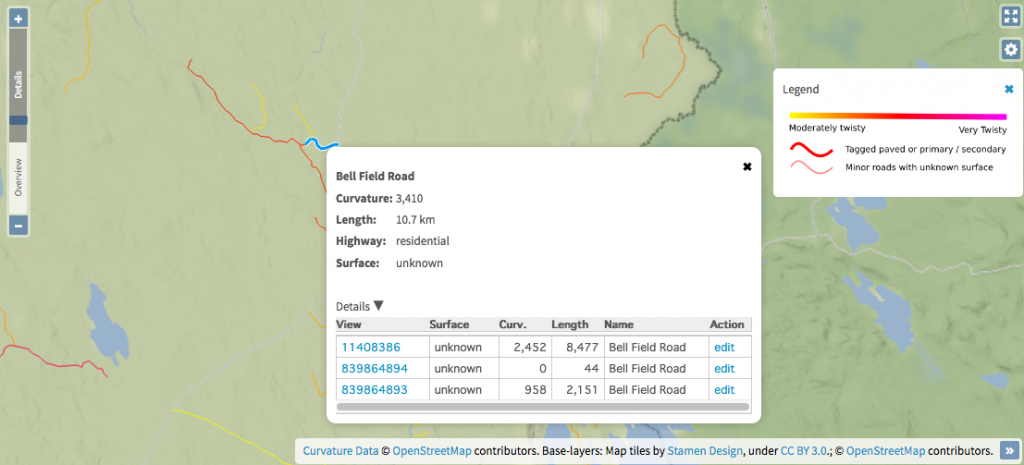
Expand the “Details” drop-down for a list of every segment that makes up a road with links to view or edit the segment in OpenStreetMap. If you are browsing the map and identify roads that are misclassified, misaligned, or don’t have a surface tagged, you can edit the road in OpenStreetMap and your changes will improve the displayed results the next time Curvature updates that part of the map.
By default clicking the “edit” link for a road segment will open OpenStreetMap’s iD editor with the road segment selected. Experienced mappers can also change the editor option in the settings panel to open the road in the JOSM editor.
Automated data updates
The Curvature database is automatically updated region by region, with a full refresh completing over the course of about a month. Edits to OpenStreetMap are continually improving the map.
Support the project
Curvature wouldn’t be possible without open data, so the biggest way to help make it better and to contribute to the project is to improve roadways in OpenStreetMap. If map editing isn’t your thing or you are willing to help Curvature thrive, I will gratefully accept donations of any amount toward offsetting some of the costs of hosting the database and webservers that make this service possible.
I can’t wait to try out some local twisty roads!!
Great resource- thanks for posting!
a video tutorial for editing maps would really help teach us how to edit maps.
Hi Frank, check out https://learnosm.org/en/beginner/ for written tutorials.
A list of video tutorials is available at https://learnosm.org/en/resources/#id
(iD is the user-friendly in-browser editor at openstreetmap.org and what you’ll get by default if you click one of the “Edit” links in the Curvature map).